
പീരുമേട്Idukki, Kerala915 m
Peermade, Kerala: a guide to the hills



Now 16° · mist in the valleys · sunrise 6:18
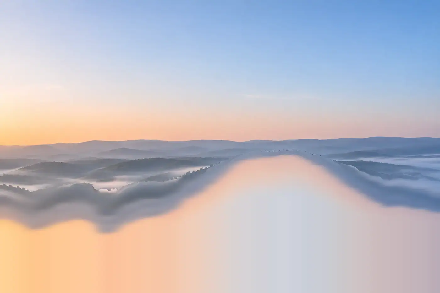
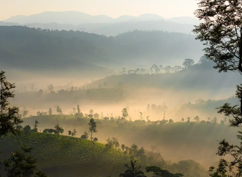
Tea hills, pine woods and rock viewpoints above a sea of morning cloud, on the hill road between Kottayam and Thekkady.
Illustration, made with AI: a December sunrise over the tea hills, not one exact viewpoint.
The place
A tea town 915 metres up in the Western Ghats, with pine woods, rock viewpoints and valleys that fill with cloud at dawn.
- Above the sea
- 915 metres
- Tea since
- 1875
- Places mapped
- 17
- From Kochi airport
- 127 km
The name is disputed. Kerala Tourism links it to the Sufi saint Peer Mohammed; a local account says it comes from guava trees, pera in Malayalam. People come for the viewpoints, the cool air and the quiet. There is no nightlife.
- District
- Idukki, Kerala
- Highway
- NH 183
- Nearest rail
- Kottayam, 76 km
- Kuttikkanam
- 4 km, about 1,100 m
Mist forecast · updated hourly
Will the valleys fill with cloud tomorrow?
On calm, humid nights fog pools in the valleys. Stand above it at sunrise and you look out over a sea of cloud. We forecast where the fog tops out, and which viewpoints sit above it.
Mist forecast
Reading the morning
Fetching the next seven mornings from Open-Meteo.
- Parunthumpara1,160 mAbove the cloudIn the cloudClear, wisps belowLong views
- Kuttikkanam1,100 mJust aboveIn the cloudClearLong views
- Peermade town915 mIn the cloudIn the cloudClearClear
- Panchalimedu760 mIn the cloudIn the cloudPatchy mistClear
How the forecast works
We read Open-Meteo’s hourly model for Parunthumpara: humidity near the ground and at about 770 m, 1,000 m and 1,450 m, plus wind and low cloud before dawn. Where the air is saturated and the wind is light, fog forms, and the highest saturated level is our fog top. Models miss small valleys, so treat it as a good guess, not a promise.
Places
Where to go
 Viewpoint
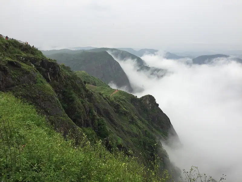
Parunthumpara
7 km · 15 minA bare rock sheet over ravines and forest, 500 m on foot from the parking. Best at first light.
 Forest
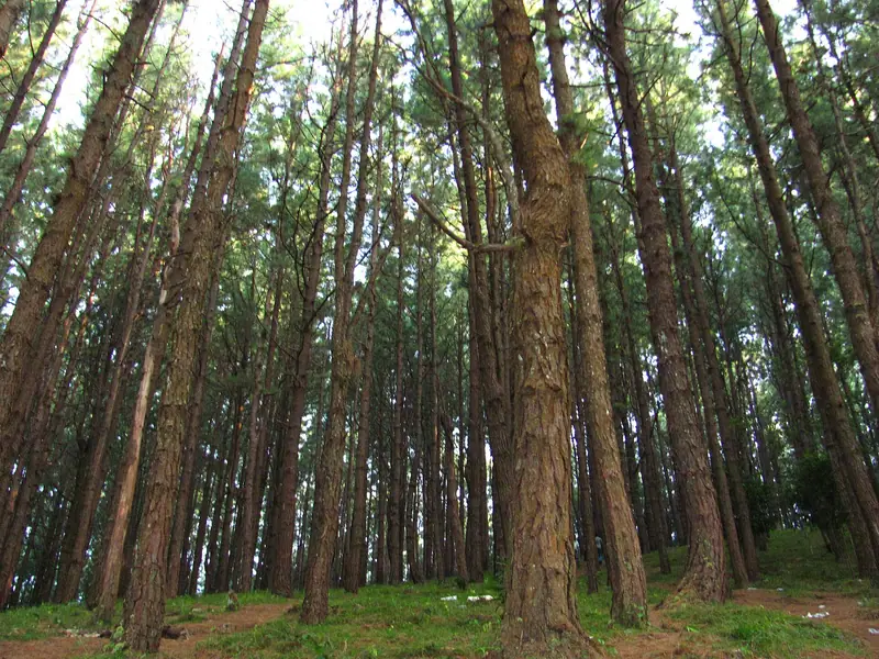
Pine forest
3 km · 5 minAbout 100 acres of planted pine at Kuttikkanam, with around 30 bird species.
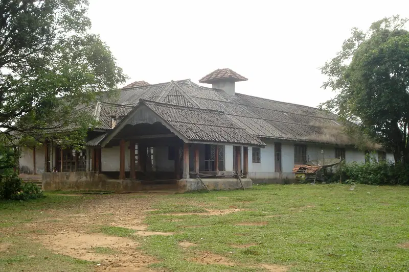 Heritage
Ammachi Kottaram
5 km · 10 minA Travancore-era retreat, now private and in poor repair. Seen from outside.
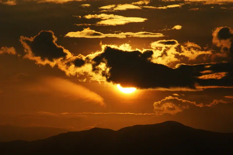 Viewpoint · Faith
Panchalimedu
14 km · 25 minA hilltop temple, a pond and an easy walkway. Makara Jyothi crowds in January.
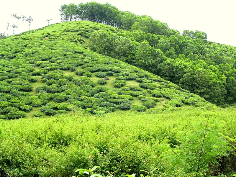 Tea
Connemara tea factory
18 km · 25 minHourly guided tours of a working garden and factory, with tasting.
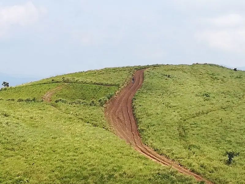 Meadows
Vagamon meadows
24 km · 40 minRolling grass hills and the paragliding take-off sites.
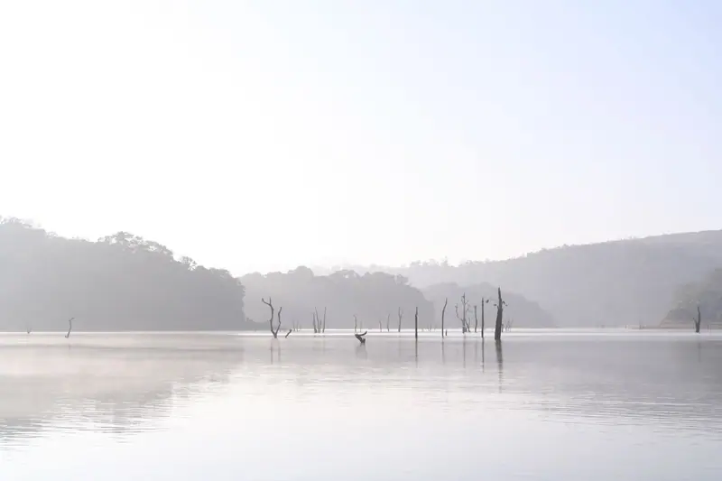 Wildlife
Periyar Tiger Reserve
35 km · 50 minBoats on Periyar lake, bamboo rafting and guided day treks. Book ahead.
Map
17 places, by road
Distances and drive times from Peermade town. Hill roads are slow and fog is common, so leave room.
 PeermadeKuttikkanamVandiperiyarKumilyMundakayamVagamon5 km10 km20 km
01 · 3 km · 5 min
Kuttikkanam pine forest
About 100 acres of planted pine off NH 183, with around 30 bird species.
Read the guide02 · 4 km · 10 min
Thrissanku Hills
Grass hills near Kuttikkanam for sunrise and sunset. Mist arrives fast.
Read the guide03 · 4 km · 10 min
Peeru Hills
The hill the town is named after, looking across to Valanjanganam.
Read the guide04 · 5 km · 10 min
Ammachi Kottaram
A Travancore-era retreat, now private and in poor repair. Seen from outside.
Read the guide05 · 7 km · 15 min
Parunthumpara
A bare rock sheet over ravines and forest, 500 m on foot from parking.
Read the guide06 · 7 km · 10 min
Pattumala
A granite Gothic-revival shrine among tea gardens on NH 183.
Read the guide07 · 8 km · 15 min
Valanjanganam Falls
A 23 m roadside fall. Full June to September, a trickle by December.
Read the guide08 · 12 km · 25 min
Elappara grasslands
Tea village on the Vagamon road; jeeps climb to the Uluppuni grasslands.
Read the guide09 · 14 km · 25 min
Panchalimedu
A hilltop temple, a pond and an easy walkway. Makara Jyothi in January.
Read the guide10 · 18 km · 25 min
Connemara tea factory
Hourly guided tours of a working tea garden and factory, with tasting.
Read the guide11 · 22 km · 45 min
Vagamon pine forest
Planted pines at Kolahalamedu, the highest point around Vagamon.
Read the guide12 · 24 km · 40 min
Vagamon meadows
Rolling grass hills and the paragliding take-off sites.
Read the guide13 · 25 km · 40 min
Vagamon glass bridge
A 40 m cantilever glass walkway in a small adventure park. Slots sell out.
Read the guide14 · 27 km · 45 min
Thangal Para
A rock hill with the tomb of Sheikh Fariduddin Baba. Uroos in April.
Read the guide15 · 31 km · 55 min
Kurisumala
A pilgrimage hill with a hilltop church and a 1950s Trappist ashram.
Read the guide16 · 35 km · 50 min
Periyar Tiger Reserve
Boats on Periyar lake, bamboo rafting and guided day treks.
Read the guide17 · 45 km · 2 h+
Pullumedu
Forest grassland on the Sabarimala route. Pilgrim season only.
Read the guideDrive times are routed distances plus a quarter for hill roads, rounded up. Terrain from Copernicus elevation data; roads and rivers © OpenStreetMap contributors.
Who it suits
Pick your kind of trip
Peermade is quiet. There are no clubs or late bars, and evenings happen where you stay. Vagamon and Thekkady are the livelier bases nearby.
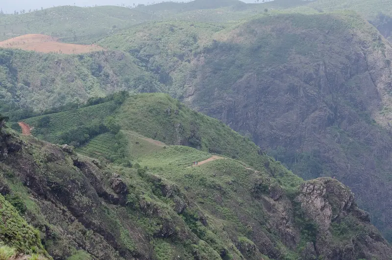
Sunrise rock, jeep tracks and a glass bridge
Come for the outdoors, not the nightlife. Start early: the best light is before 8 am, and plantation tracks near forest are off limits after 6 pm.
- 7 km
Parunthumpara at sunrise
Drive to the parking, then 500 m on foot to the rock.
- 12 km
Jeep to the Uluppuni grasslands
Jeeps leave from Elappara. Agree the price before you set off.
- 25 km
Vagamon glass bridge
Timed slots. Tickets are quoted at Rs 250 to 500, so check before you go. Book ahead for weekends.
- 24 km
Paragliding at Vagamon
Tandem flights from the meadows when the weather allows.
Mist, pine and a lake at dusk
Stay on a tea estate and keep the days slow. Most viewpoints are a short walk from the car.
- 4 km
Thrissanku Hills at sunset
Grass hills near Kuttikkanam. Mist can roll in within minutes.
- 3 km
Kuttikkanam pine forest
A morning walk under planted pines, with around 30 bird species.
- 24 km
Vagamon meadows and pines
Rolling grass and the Kolahalamedu pine forest, an easy half day.
- 35 km
A boat on Periyar lake
Forest Department boats from Thekkady. Book ahead.
Walks, old churches and quiet hills
Easy to do alone and rarely crowded. Carry water, and be off forest-edge roads by dusk.
- 4 km
Peeru Hills
A short climb with views across to Valanjanganam.
- 3 km
Birding in the pine forest
Go early, when the forest is quiet and the mist is still in.
- 7 km
Pattumala shrine and tea gardens
A granite church among tea bushes. Dress modestly.
- In town
St George’s CSI Church
Built in 1867, with planters' graves in the churchyard.
Short walks and easy views
Pick places with parking close by. Panchalimedu has a paved walkway, ramps and wheelchairs on request.
- 14 km
Panchalimedu
Rock walkway, benches, a pond and a hilltop temple.
- 8 km
Valanjanganam Falls
Seen from the road. Full June to September. No bathing.
- 18 km
Connemara tea factory
Guided tours of the garden and factory, with tasting.
- 35 km
Periyar boating
Morning boats are calmer. Book with the Forest Department.
Treks need permits, flights need wind
Most real trekking is run by the Forest Department and needs booking. Monsoon alerts can pause everything at short notice.
- 35 km
Periyar day trek and bamboo rafting
Forest Department programmes inside the tiger reserve.
- 24 km
Paragliding at Vagamon
Tandem flights, weather permitting.
- 12 km
Elappara jeep tracks
Rough tracks up to open grassland.
- 45 km
Pullumedu forest route
Open in Sabarimala season for pilgrims. Access for others is not confirmed.
Shrines of three faiths within an hour
Hill churches, a dargah and temples, with big crowds at festival time.
- 7 km
Pattumala shrine
Our Lady of Good Health, known locally as Kochu Velankanni.
- 27 km
Thangal Para
Tomb of Sheikh Fariduddin Baba on a rock hill. Uroos in April.
- 31 km
Kurisumala
A hilltop church and the Easter pilgrimage climb.
- 14 km
Panchalimedu
Makara Jyothi viewing around 14 January.
Seasons
When to come
December to February is dry and clear. The south-west monsoon runs June to September, and October and November still bring storms.
January
26° / 15° · 36 mm
The driest, clearest month. Dawn at the viewpoints is cold; Kerala Tourism puts winter lows near 10 °C. Makara Jyothi brings big crowds to Panchalimedu and Pullumedu around 14 January.
February
28° / 15° · 34 mm
Still dry, with long views. Grass on the hills turns gold and the waterfalls are down to a trickle.
March
28° / 17° · 100 mm
Warm afternoons and hazier views. The first pre-monsoon storms arrive late in the month.
April
27° / 18° · 236 mm
Thunderstorms on many afternoons, so plan outdoor time for the morning. Uroos is held at Thangal Para this month.
May
25° / 19° · 441 mm
The south-west monsoon usually arrives at the end of the month. Showers turn heavy and the mist settles in.
June
22° / 18° · 460 mm
Heavy rain, thick mist and full waterfalls. Check Idukki district alerts before driving: night travel and treks can be stopped at short notice.
July
22° / 18° · 478 mm
Deep monsoon. Valanjanganam is at its fullest. Viewpoints are often lost in cloud by mid-morning.
August
22° / 18° · 522 mm
The wettest month in this data. In August 2026 a red alert closed adventure activities and barred night travel in the hills.
September
23° / 18° · 399 mm
Rain eases toward the end of the month. Green hills, full falls and few visitors.
October
23° / 17° · 443 mm
The north-east monsoon brings afternoon storms. Mornings are often clear, so start early.
November
24° / 17° · 245 mm
Rain tapers off through the month. Sabarimala season starts in mid-November, so expect pilgrim traffic on NH 183 and busy viewpoints at weekends.
December
24° / 16° · 104 mm
Dry again and cooling. Clear mornings, cold nights, and holiday crowds over Christmas week.
Plan
One day, done well
Parunthumpara
Drive 15 minutes, walk 500 m, and be on the rock before the 6:18 sunrise. Give the light an hour.
Pattumala
15 min on. The granite shrine and its tea gardens on NH 183.
Thrissanku Hills or Panchalimedu
20 min on. Grass hills near Kuttikkanam, or the easy walkway at Panchalimedu.
Lunch in Kuttikkanam
Simple Kerala meals. Few places open late, so eat while you can.
Ammachi Kottaram and the pines
See the palace from outside, then walk the pine forest.
Valanjanganam Falls
Roadside. Worth it June to September. Head back before dark.
Longer trips
Two days: add Vagamon. Pine forest and meadows in the morning, the glass bridge or paragliding at midday, Thangal Para or Kurisumala after.
Three days: add Thekkady for a Periyar boat or day trek, and stop at the Connemara tea factory on the way back.
Getting here
| Kochi airport | 127 km | 2.5 to 3 h |
|---|---|---|
| Kottayam railway | 76 km | 1.5 h |
| Thekkady | 35 km | 50 min |
| Vagamon | 29 km | 50 min |
| Munnar | 103 km | 2.5 h |
| Madurai airport | 179 km | 4 h |
| Trivandrum airport | 181 km | 4 h |
Questions
Before you go
Facts checked 21 Nov 2026 against Kerala Tourism, DTPC Idukki and news reports.
Is Peermade worth visiting?
Yes, if you want a quiet plantation town with short walks to big views and an easy base for Vagamon and Thekkady. No, if you want nightlife or big attractions.
Peermade or Vagamon?
Peermade is lower and quieter, with more tea estates and history. Vagamon, 29 km away, has the meadows, the glass bridge, paragliding and more visitors. Many people stay in one and day-trip to the other.
When is the best time to visit?
December to February for dry, clear days. Kerala Tourism suggests September to May for less rain, but the climate averages show October and November are still wet. June to September brings heavy rain, mist and full waterfalls.
How cold does it get?
Modelled average lows are 15 to 19 °C, but viewpoints feel colder at dawn, and Kerala Tourism says winter nights sometimes drop to about 10 °C. Bring a warm layer from November to February.
How do I get there from Kochi?
About 127 km by road from Kochi airport, 2.5 to 3 hours. The last stretch climbs NH 183 through Mundakayam and Kuttikkanam. The nearest railway station is Kottayam, 76 km away.
Is there an entry fee at Parunthumpara?
We found no fee. One listing gives hours of 6 am to 6 pm, and there is no night opening.
Can I go inside Ammachi Kottaram?
It is private property in poor repair. See it from outside unless you have the owner’s permission.
Is it safe to drive at night?
NH 183 stays open, but fog is common and animals cross. Rain alerts can bar night travel in the hills, and tracks inside plantations near forest are restricted from 6 pm to 6 am.
Is there any nightlife?
No. There are no clubs and few places stay open late. Evenings are at your homestay or resort. Thekkady is the nearest busy town.